Groundwater quality database with maps of CG prepared
| Date :29-Aug-2019 |
By Abhishek Kumar
‘For the first time in State, an attempt has been made by the CCOST to create ground water quality maps on 1:50,000 scale by using the ground water quality -CCOST scientist M K Beg
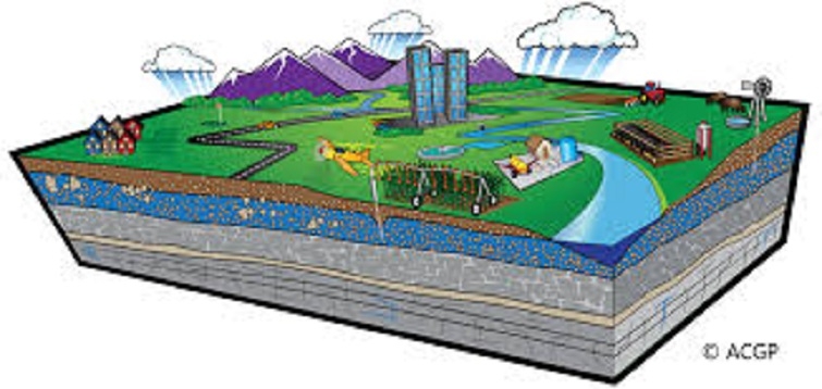
In a bid to provide clean and pure drinking water to the people of the State, Chhattisgarh Council of Science and Technology (CCOST), in collaboration with National Remote Sensing Centre, Indian Space Research Organisation (ISRO), Hyderabad has prepared ground water quality map on 1:50,000 scale through satellite and remote sensing and Geographical Information System (GIS) technique in all 27 districts of the state under Rajiv Gandhi National Drinking Water Mission (RGNDWM) project.
The project was sponsored by Department of Drinking Water Supply (DDWS), Ministry of Rural Development (MoRD), Government of India. Speaking to ‘The Hitavada’, senior scientist of CCOST M K Beg confirmed that the CCOST prepared 243 ground water quality maps by using around two lakh pre-monsoon and post monsoon ground water quality data of drinking water sources under Rajiv Gandhi National Drinking Water Mission (RGNDWM). Mapping of the quality of ground water, particularly, using legacy data is a technically challenging task. There are many factors that govern the quality of the water and its distribution in space and time.
Availability of data pertaining to all the governing parametres is also a major issue. In most of the cases, the spatial distribution of the quality of ground water has been depicted in terms of the locations of the wells having quality problem with respect to different elements, the senior scientist added. Beg further elaborated that ground water quality map showing the spatial distribution of the quality of ground water is the main output of the project.
The ground water quality information has been generated by considering 10 common elements – pH, Alkalinity, arsenic, Hardness, Chloride, Fluoride, Iron, Nitrate, sulphate and Total Dissolved Solid (TDS) – as a mandate in the input legacy data. For the first time inState, an attempt has been made by the CCOST to create ground water quality maps on 1:50,000 scale by using the ground water quality data. District-wise Groundwater Quality Maps have been prepared for pre-monsoon and post monsoon seasons under GIS environment. The CCOST generated rail, road, settlement, administrative boundaries, geology, canal, drainage and water sources for preparing the ground water quality map. Generally, contamination occurred due to anthropogenic activities mainly agriculture, urbanisation, industrialisation, solid waste dump and excess withdrawal of ground water, he described.
The senior scientist said that the ground water quality maps will be useful for locating drinking water sources and understanding the spatial pattern of ground water quality effecting due to individual element also for identifying suitable sites for constructing recharge structures to improve the sustainability and quality of the drinking water sources which needs to be monitored periodically. For continuous monitoring of ground water, it is necessary to set up a modernised lab with experienced technical support in every district of the state.
The CCOST has handed over all 243 map sheets to the NRSC, ISRO Hyderabad for evaluation, Beg added. It may be mentioned that the project started in 2010 and it was competed in 2019. Due to non availability of pre-monsoon and post monsoon ground water quality data for all ground water sources, Public Health Engineering Department, Government of Chhattisgarh initiated a massive programme to collect and analyse the ground water quality data of all the drinking water sources. This was a challenging task for the Public Health and Engineering Department.