Rainwater harvesting for self-reliant rural areas
| Date :24-Nov-2020 |

Staff Reporter :
Raipur,
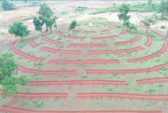
The Narva Development Yojana under the scheme of Narva, Garva, Ghurva, Bari, forms the very basis of rural development. It is based on State Government’s ambitious Suraji Village scheme and is purely based on the watershed concept under MGNREGA’s guidelines and instructions for rainwater harvesting, irrigation and livelihood generation. A DPR has been prepared by the District Panchayat Bastar, for rainwater harvesting according to the Reads to Valley concept, under this project. Various Structures will be built with water retention capacity which are capable of recharging rainwater for further use through surface storage or groundwater.
The general Livelihood has been affected due to climate change, low rainfall and low irrigation potential. The main objective of this scheme is to create a self-reliant livelihood in rural areas as they heavily depend on rainwater for irrigation and agriculture-based works. All seven blocks of Bastar district fall under the MWC (Mission Water Conservation) as arid and deprived of irrigation areas. There has been a drastic change in the rainfall pattern and the availability of water for irrigation since the past few years in the district. Additionally, the groundwater level has also decreased.
Concerning these reasons, the project has become of major importance in the district. A detailed action plan has been prepared, by selecting a total of 65 drains in the district to be treated under the Narva Scheme. Physical survey of drains and GIS satellite has been used to prepare the action plan. The survey covers a total of 5,125 small and big projects to be conducted on these channels, who’s catchment capacity is 1,04,483 hectares and the total length of the drain is 624.65 km. 158 Gram Panchayats are being covered by these 65 drains, for which the task is being done as per required, with SCT, CCT, afforestation, brushwood, street plug, LBC, Gabion, stop dam, check dam, irrigation canal, farm pond, wells, new ponds etc. Treatment of these drains is quintessential for the watershed concept.
The scheme has been prepared using the GIS method and ground level survey at the gram panchayat level to resolve the issues of water requirements at the gram panchayat-level. GIS-based software such as Google Earth etc has been used. Concerning the better implementation of the scheme, we use different layers of Bhuvan portal for better understanding of the drain and planning it accordingly. To ensure better efficiency of the scheme, an action plan is being prepared to achieve maximum output to increase water availability and irrigation capacity to strengthen livelihoods in the Gram Panchayats.