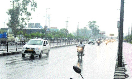
Rain plays truant across State
| Date :24-Jun-2022 |

Staff Reporter
Madhya Pradesh should receive 3 inches of rain till June 1 and as of now this quota has been met. However, this time the areas of rainfall have changed as compared to last year. Two people died due to lightning in Pandhurna of Chhindwara. At the same time, three people got burnt.
According to the Meteorological Department, there is a possibility of lightning with heavy rain in Betul, Balaghat, Seoni and Chhindwara in the next 4-5 hours. The department has issued a red alert in these districts. Apart from this, a yellow and orange alert has been issued for other districts. Bhopal-Indore was cloudy with strong wind. There is a chance of rain here as well.
Due to the availability of moisture from the Arabian Sea, rain may occur at isolated places in Narmadapuram, Bhopal, Indore and Ujjain. Here, light to moderate rain from Bay of Bengal to Anuppur, Mandla, Satna, Rewa, Dindori, Singrauli, Shahdol and Jabalpur will remain for two to three days. Khandwa, Dewas, Chhindwara, Betul and Burhanpur received 2 to 3 cm of rain due to the availability of moisture from both the Bengal and Arabian Sea sides. Light to moderate rain may occur here on Thursday as well.
Below normal rain in Bhopal-Indore: Last year, from June 1 to June 30, the State had received 2 inches more rain i.e. 35 per cent more than normal i.e. 5 inches, but this time it has so far met the quota of 3 inches. The special thing is that in the year 2021, there was good rainfall in Indore and Bhopal. In Bhopal, the water had fallen up to 12 inches instead of the normal 5 inches. This time it is the opposite. Bhopal has received only two inches of rain so far. This is about 1 inch i.e. 30 per cent less than the quota. In Indore, not even two inches of water fell instead of three inches. This is about 41 per cent less than normal. So far, due to the blessings of the clouds, the maximum water has fallen in Sheopur, up to 4 inches instead of one and a half inches and in Vidisha, 6 inches more water has fallen instead of Kota’s half inch rain. So far, only 15 areas of the state have received normal or more rain. Till 8 am, 1 inch of rainfall fell in Mandla and Satna. Half-an-inch of rain fell in Bhopal and Khandwa. Light rain occurred at isolated places in Dhar, Guna, Ratlam, Malanjkhand, Sagar, Khargone, Indore, Ujjain, Rajgarh and Gwalior. Four-day break in monsoon in MP: After the stormy entry, the monsoon rains in Madhya Pradesh are expected to take a break of 4 days. Due to the formation of local level clouds (CB cloud) on all four days, it may rain in different cities after evening, but there is a possibility of rain in Gwalior-Chambal only after 4 days. From June 27, there is a possibility of heavy rain in the entire state including Indore, Bhopal for four consecutive days.
According to senior Meteorologist Vedprakash Singh, the Arabian Sea and Bay of Bengal branch is not active yet. The formation of low-pressure areas has stopped and due to this the monsoon rains have come to an end. Since June 26, the cyclonic circulation in the Bay of Bengal near the Odisha coast is showing signs of becoming active.
This system is active now: A trough is accompanied by cyclonic activities over Jammu. The East-West Trough extends up to Rajasthan, Haryana, Uttar Pradesh, Bihar, West Bengal and Northwest Bay of Bengal. Cyclonic activities are active over Northwest Rajasthan. An offshore trough is extending from South Maharashtra to North Kerala coast. Also, the cyclone is active over East Jharkhand as well as the Odisha region.
The Northern Limit of South West Monsoon is passing through Porbandar, Baroda, Shivpuri, Rewa.