2 back-to-back mild tremors felt in Chandrapur distt
| Date :17-Nov-2026 |
Staff Reporter
Two back-to-back tremors spread
panic among residents of Chandrapur district on Monday evening. The first tremor was felt at 4.14 pm of 3.2 Magnitude and the second one was at 5.30 pm of 2.8 Magnitude.
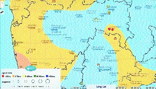
According to National Centre for Seismology (NCS) website, the first earthquake was felt near Marda village in Chandrapur district. The epicentre of the tremor was in 5 km depth.
Similarly, the second earthquake took place at Korti Makta village, of Ballarpur taluka in Chandrapur district. The epicentre of second quake was 10 km underground. Both quakes were felt around 150 km south-southeast of Nagpur city. The epicentre of both earthquakes was reported in the Ballarpur-Rajura area.
The mild tremors was felt in some areas but no loss of property or life was reported in the district by the administration.
Such earthquakes in the region are likely taking place due to intraplate geological conditions and hydro-seismicity rather than major tectonic plate boundaries. Vidarbha lies far from major tectonic plate boundaries on the Deccan Plateau. However, the Indian Plate continues its continuous northward movement and internal deformation, building up mechanical stress deep within the continental interior, claimed Prof Suresh Chopane, President, Green Planet Society. Interestingly, the Ballarpur area is not traditionally considered an earthquake-prone area. Tremors can be felt in Ballarpur area due to geographical conditions and human intervention, claimed Prof Chopane. The frequent tremors in the region raised concern for the administration and experts believes that intensity may increase in near future. Therefore, there is a need to study the geological changes taking place in the region, claimed Prof Chopane.
Since there is a large
network of coal mines in the Ballarpur and Rajura areas, it is essential to study the impact of mining on groundwater movement and the internal structure of the soil, said the expert.