State witnesses rains, hailstorm, sharp Change in weather brings relief from intense heatdip in temp
| Date :31-May-2026 |
Staff Reporter :
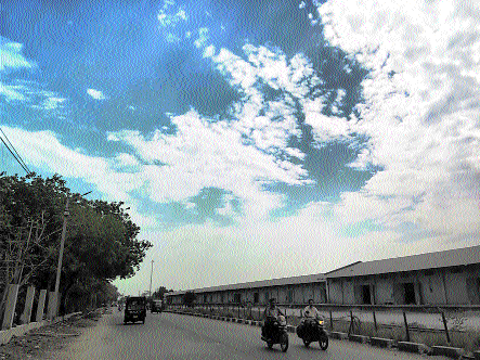
A powerful combination of a western disturbance and active low-level weather troughs has triggered widespread thunderstorms, heavy rainfall, hailstorms, and strong winds across Madhya Pradesh. The sudden change in weather has provided significant relief from the intense summer heat, causing maximum temperatures to fall by as much as 7.9°C in several regions. At the same time, the Indian Meteorological Department (IMD) reported further advancement of the Southwest Monsoon over the Arabian Sea and the Bay of Bengal, creating favourable conditions for its arrival over the Indian mainland within the next four to five days.
Heavy rainfall, hailstorms, and strong winds across the State: Many districts experienced severe weather activity.
The Gwalior and Chambal divisions received rainfall at most places, while several locations in the Sagar division recorded significant precipitation. Heavy rainfall accompanied by severe hailstorms was reported from Shivpuri, Morena, Sagar, and Sheopur districts.
Gormi recorded the highest rainfall in the State at 72.0 mm, followed by Narwar with 44.0 mm, Tendukheda with 38.0 mm, Bairad with 31.0 mm, and both Shujalpur and Mohangarh with 29.0 mm.
The storm systems also generated damaging winds across several districts. Ashoknagar recorded the highest wind speed of 70 km/h, while Gwalior and Shivpuri experienced gusts reaching 67 km/h.
Sehore witnessed winds of 59 km/h, and Narsinghpur and Agar Malwa recorded speeds of 50 km/h. Strong winds were also reported in Sagar (48 km/h), Guna (48 km/h), Indore (43 km/h), and Bhopal (41 km/h).
Significant fall in temperature: Persistent cloud cover and rainfall led to a substantial decline in daytime temperatures across Madhya Pradesh. Maximum temperatures dropped sharply by 5.3°C to 7.9°C in parts of the Gwalior, Rewa, and Sagar divisions. The Gwalior division remained notably cooler, with daytime temperatures averaging 5.8°C below normal.
Other divisions, including Bhopal, Ujjain, Chambal, Jabalpur, and Shahdol, also experienced a noticeable decrease in maximum temperatures ranging between 2.1°C and 3.3°C. Night temperatures declined significantly as well, particularly in the Bhopal and Chambal divisions, where minimum temperatures fell by around 4.3°C.
Minimum temperatures remained 5.3°C to 6.5°C below normal across the Gwalior, Chambal, Rewa, and Sagar divisions. However, some areas continued to experience thermal discomfort, with a severe warm night reported in Seoni district and a warm night observed in Chhindwara district.
Temperature extremes across Madhya Pradesh:
The State witnessed a remarkable contrast in temperatures during the last 24 hours. Narsinghpur recorded the highest maximum temperature at 43.6°C, followed by Raisen at 43.0°C, Vidisha and Narmadapuram at 42.5°C, and Rajgarh at 42.4°C.
In contrast, cooler daytime conditions prevailed in several locations, with Gwalior recording the state’s lowest maximum temperature of 34.5°C. Amarkantak registered a maximum of 35.0°C, while Chitrakoot
recorded 35.4°C. Damoh recorded the lowest minimum temperature at 18.6°C, whereas Chhindwara reported the highest minimum temperature at 29.4°C. The city recorded a maximum temperature of 40.6°C, which was 0.7°C below normal, while the minimum temperature settled at 25.6°C. The IMD has forecast a partly cloudy sky for Bhopal and surrounding areas, with a strong possibility of thunderstorms, lightning, and light rainfall during the evening. Winds are expected to blow at speeds of 16 to 18 km/h. The maximum and minimum temperatures are likely to remain around 37°C and 26°C respectively.
Across Madhya Pradesh, maximum temperatures are expected to decrease further by 2°C to 3°C over the next three days before stabilising.
The ongoing weather activity is being driven by multiple interacting meteorological systems.
A western disturbance is currently active as a cyclonic circulation over northwest Uttar Pradesh, extending between 3.1 km and 5.8 km above mean sea level.
An additional upper-air cyclonic circulation persists over central Pakistan and adjoining areas, extending up to 1.5 km above mean sea level. A significant low-level trough extends from this circulation to the north coastal Andhra Pradesh region, passing through Rajasthan, Madhya Pradesh, Chhattisgarh, and southern Odisha. This trough is continuously supplying moisture and energy to the atmosphere, supporting widespread thunderstorm development.
IMD issues weather alerts:
The Meteorological Centre, Bhopal, has issued orange and yellow alerts valid until the morning of May 31. Severe weather warnings for heavy rainfall, hailstorms, and squally winds reaching 50–60 km/h have been issued for isolated areas of Mandsaur and Neemuch districts. Similar hailstorm and strong wind warnings are in effect for parts of Gwalior, Datia, Bhind, Damoh, Chhatarpur, Tikamgarh, and Niwari districts. Thunderstorms accompanied by gusty winds of 40–50 km/h are also expected across a large part of the state, including the divisions of Bhopal, Indore, Ujjain, Jabalpur, Rewa, Narmadapuram, and Shahdol. In contrast, dry weather conditions are expected to prevail in Betul, Harda, Burhanpur, Khandwa, Khargone, and Barwani districts.