Heavy rain continues across State
| Date :18-Jul-2026 |
BHILAI :
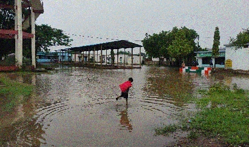
Widespread rainfall continued across Chhattisgarh over the past 24 hours, with several
areas receiving heavy to very heavy rain under the influence of a low-pressure area over Gangetic West Bengal and adjoining Jharkhand and North Odisha.
The India Meteorological Department (IMD), Raipur, has forecast further rain activity across the state during the next two days. According to the weather report, light to moderate rain occurred at most places in the State, while a few locations experienced heavy to very heavy rainfall. Bilaspur recorded the highest rainfall of 28 cm, followed by Akaltara with 17 cm and Gidhori Tundra with 13 cm.
Several other places in central Chhattisgarh also received substantial rainfall. The weather system responsible for the rain is a low-pressure area located over Gangetic West Bengal and adjoining Jharkhand and North Odisha.
The associated cyclonic circulation extends up to 5.8 km above mean sea level and is expected to weaken gradually during the next 24 hours.
Meanwhile, the monsoon trough is passing through Amritsar, Chandigarh, Shahjahanpur, Basti, Patna and the centre of the low-pressure area before extending towards the northeast Bay of Bengal. The IMD has forecast light to moderate rainfall at most places in Chhattisgarh on July 18. Heavy to very heavy rainfall accompanied by thunderstorms and lightning is likely at isolated locations. Similar weather conditions are expected to continue for the following two days, although rainfall activity may reduce after 48 hours. Raipur recorded a maximum temperature of 26.8 degrees Celsius, which was 4.1 degrees below normal, while the minimum temperature was 23.9 degrees Celsius. In Durg, the minimum temperature was recorded at 23.4 degrees Celsius, while Rajnandgaon reported the State’s lowest minimum temperature at 21.5 degrees Celsius. The seasonal rainfall over the state remains 27 per cent below normal despite the recent widespread showers.