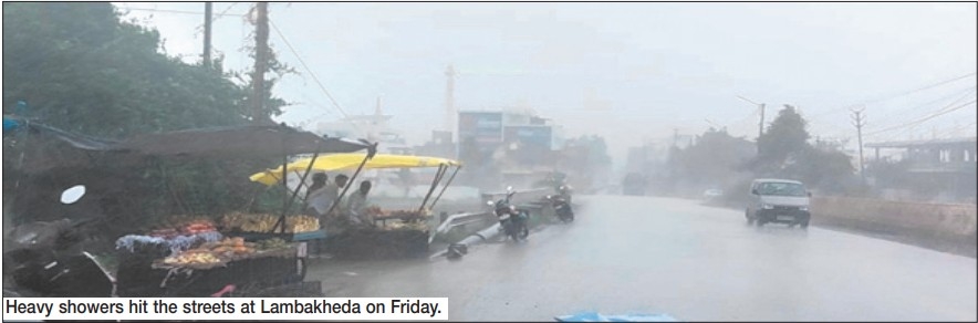
Depression over Vidarbha triggers heavy rains across MP■ Gogawan records 190 mm rain ■ Scattered to isolated rain expected for today
| Date :01-Aug-2026 |
Staff Reporter :
WIDESPREAD rainfall lashed
major parts of the State as a
depression over western
Vidarbha and adjoining south
Madhya Pradesh continued to
move west-northwestwards. The
weather system, centered roughly 90 km south-southeast of Betul
and 210 km east-southeast of
Khandwa, is expected to weaken into a well-marked low-pressure area by August 1.
Precipitation was recorded at
most locations across the Indore,
Narmadapuram and Ujjain divisions, and at many places across
Bhopal, Gwalior, Rewa, Jabalpur,
and Shahdol divisions. A few
areas in the Chambal and Sagar
divisions also received rainfall.
Gogawan lashing leads heavy
rain figures
Extremely heavy to very heavy
downpours were recorded in several southern and western districts. Gogawan recorded the
state’s highest rainfall at 190.0
mm, followed by Burhanpur
(176.0 mm), Bhimpur (165.0
mm), Warla (161.0 mm),
Udaigarh (132.2 mm), Khaknar
(130.0 mm), and Khandwa (128.0
mm). Heavy rainfall was also
reported from Chachariyapati
(113.0 mm), Barwaha (111.0
mm), Shegaon (108.0 mm),
Khargone (106.0 mm), Thikri
(105.2 mm), Ranapur (101.0
mm), Pandhana (95.0 mm),
Bhagwanpura (88.0 mm), Jhabua
(87.8 mm), and Sendhwa (87.0
mm). In addition to heavy precipitation, strong gusty winds
blew across several districts, with
wind speeds peaking at 54 km/h
in Jabalpur, 52 km/h in Sehore,
49 km/h in Gwalior, 44 km/h in
Seoni, and 41 km/h in Betul,
Morena, and Umaria.
Sheopur records highest temperature at 35.4°C
Maximum temperatures registered an appreciable rise of
3.0°C in districts under the
Chambal division, remaining
3.1°C above normal.
Temperatures in Bhopal,
Narmadapuram, and Ujjain divisions remained 1.8°C to 2.4°C
above normal, with no significant
variation across the rest of the
state.
Sheopur recorded the
state’s highest maximum temperature at 35.4°C, followed by
Khajuraho (34.2°C) and Gwalior
(34.1°C). Pachmarhi recorded the
lowest maximum temperature
at 26.4°C. Minimum temperatures remained largely
unchanged across divisions.
However, night temperatures
were 1.8°C below normal in the
Indore division, while rising 3.3°C
above normal in Shahdol division. Khandwa and Khargone
recorded the lowest minimum
temperature in the state at 18.4°C,
whereas Talun in Barwani registered the highest minimum temperature at 27.4°C, closely followed by Gwalior at 27.3°C.
Active synoptic systems keep
alert active
According to the meteorological center, multiple interacting
weather systems are driving the
ongoing monsoon spell across
the State. The sea-level trough
passes through Jaisalmer,
Udaipur, Indore, the center of
the depression over western
Vidarbha/south MP, and
Gopalpur toward the Bay of
Bengal. A fresh trough in the middle tropospheric westerlies runs
along Longitude 71°E to the north
of Latitude 30°N. An active shear
zone runs along Latitude 21°N
from the northeast Arabian Sea
across South Gujarat and North
Madhya Maharashtra. A sea-level trough persists from South
Gujarat to the North Kerala coast.
For Bhopal and its vicinity, the
sky is expected to remain generally cloudy with the likelihood
of thunderstorms, lightning, and
rain through Saturday morning.
Average wind speeds in the
capital will range between 14 and
16 km/h, with maximum and
minimum temperatures expected to hover around 30°C and
25°C, respectively.
Forecast for August 1
Western border districts,
including Neemuch, Mandsaur,
Ratlam, Jhabua, and Alirajpur,
are expected to experience fairly widespread rainfall (rainfall at
many places). Meanwhile, a
prominent central and northern
belt covering Indore, Ujjain,
Dewas, Dhar, Khargone,
Khandwa, Burhanpur, Barwani,
Bhopal, Sehore, Raisen, Vidisha,
Rajgarh, Shajapur, Agar Malwa,
Guna, Sheopur, Morena, and
Bhind will witness scattered
showers (Rainfall at Few Places).
Eastern and remaining northern regions, such as Gwalior,
Jabalpur, Sagar, Rewa, Shahdol,
and Narmadapuram divisions,
are projected to see scattered, isolated rain. The alert warns residents and local authorities against
widespread thunderstorm activity, frequent lightning strikes, and
strong gusty winds blowing at
speeds between 40 to 50 km/h.
Disaster management teams and
citizens have been advised to stay
cautious, monitor real-time
weather advisories, and take necessary precautions against sudden squalls and localised waterlogging throughout the day.