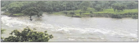
Rivers in spate, dam gates opened; warning in 15 distts, Monsoon turns ferocious in State as Narmada, Kaliasot swell; Bhopal administration issues alert for low-lying areas
Date :07-Sep-2026
Staff Reporter :
MADHYA Pradesh is witnessing
the most intense phase of this
monsoon, with swelling rivers,
overflowing reservoirs and fresh
alerts across the State. After
pounding the eastern region, the
active monsoon system has now
shifted to western and northern
Madhya Pradesh, pushing major
rivers including the Narmada
above danger levels.
In the State capital, the administration opened gates of both
Bhadbhada and Kaliasot dams
after the Upper Lake reached its
Full Tank Level of 1666.80 feet.
According to Water Resources
Department officials, four gates
of Kaliasot were opened on
Saturday evening and were
closed gradually as pressure
reduced, with one gate remaining open through the night. In
Jabalpur, gates of the Bargi Dam
have also been opened to release
excess water. Authorities have
advised residents living along the
Kaliasot river and Narmada ghats
to stay away from the banks and
maintain vigil. bace
The weather office has issued
a heavy rain alert for Sunday in
15 districts - Gwalior, Morena,
Bhind, Datia, Shivpuri, Guna,
Ashoknagar, Rajgarh, Niwari,
Tikamgarh, Chhatarpur, Sagar,
Damoh, Panna and Satna.
Meanwhile, light to heavy rainfall is likely in Bhopal, Raisen,
Sehore, Vidisha, Indore, Ujjain,
Narmadapuram, Betul, Harda,
Sheopur, Jabalpur, Mandla,
Rewa, Sidhi and Singrauli.
Current forecasts confirm showers and thunderstorms continuing across the State on
September 6 and 7.
Rainfall deficit narrows
THE continuous downpour has
significantly improved the
State’s rainfall figures. Districts
including Anuppur,
Chhatarpur, Maihar, Mandla,
Niwari, Panna, Satna, Shahdol,
Sidhi, Singrauli, Tikamgarh,
Umaria, Bhopal, Guna, Gwalior,
Rajgarh, Sheopur and Shivpuri
have already recorded abovenormal rainfall. However, some
districts in western Madhya
Pradesh still report a deficit
ranging from 2% to 53%.
The State had received 14%
below-normal rain in June. Good
showers in July and August followed by the active September
system have narrowed the gap.
Against an average seasonal
requirement of about 37.3 inches, the state has so far received
over 30 inches.
Meteorologists said the present system will remain active on
September 6, with heavy rain
likely to continue in parts of the
State on September 7, 8 and 9. If
the trend continues, the remaining deficit for the season is
expected to be wiped out in
September itself.
The district administration
has appealed to people residing
in the low-lying and riverside
areas to remain cautious and follow official advisories.