Narendra Nagar RuB: Waterlogging persists due to local seepage
| Date :14-Oct-2019 |
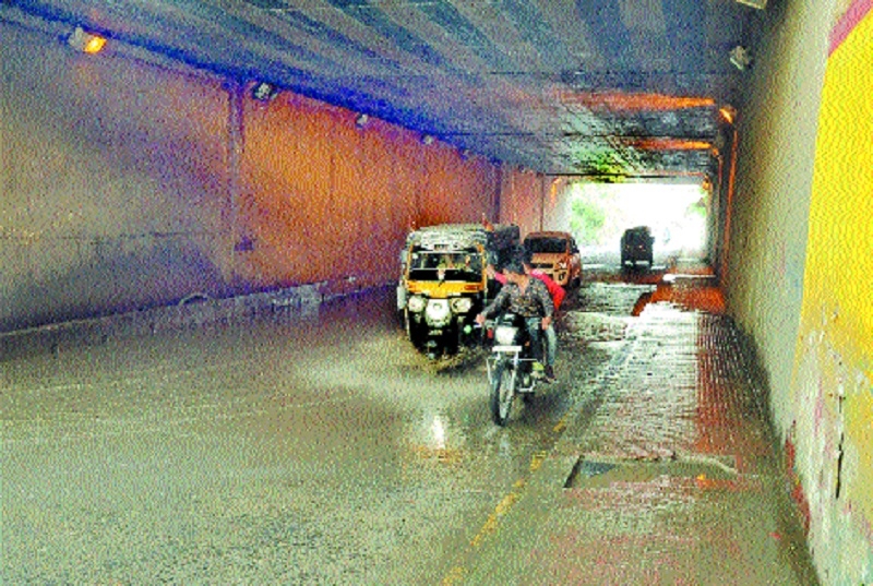
Vehicles negotiating the water accumulated in Narendra Nagar RuB even though there was no rainfall in the city for 10 days. (Pic by Satish Raut)
By Kartik Lokhande :
Waterlogging affecting flow of traffic through Narendra Nagar Railway Under Bridge (RuB) is not a new problem anymore. The people of Nagpur, as has become their trait, are getting used to it without holding the authorities responsible. However, as is widely perceived, waterlogging is not due to nullah nearby, but due to surface runoff, seepage of groundwater and drain water. A spot visit by ‘The Hitavada’ team revealed that water was seeping through wall of the RuB and flowing towards Chhatrapati Nagar end of the under-bridge. There, water remained accumulated.
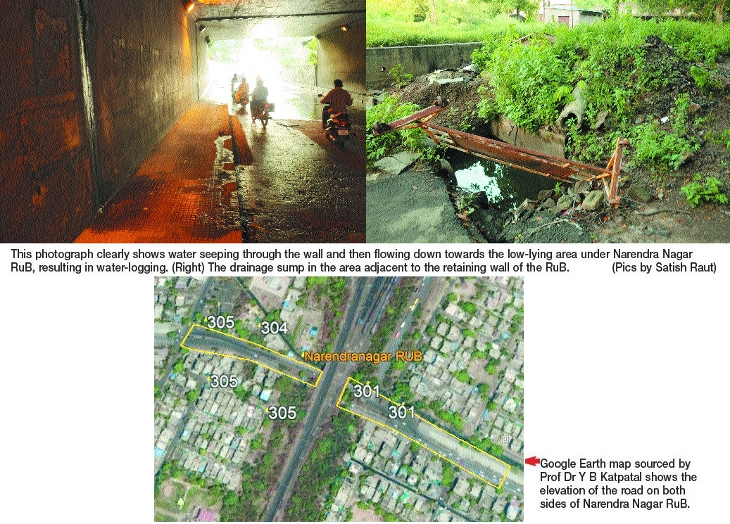
Even on Sunday, which was at least 10 days since the last spell of rainfall, road users had to wade their vehicles through waterlogged portion from Narendra Nagar-Chhatrapati Nagar side of the RuB. The other end -- Shri Krishna Mandir to CONCOR -- of the RuB did not have waterlogging. Interestingly, the nullah is adjacent to this side. A closer look of the area adjacent to the RuB side where waterlogging is a regular feature especially during monsoon, reveals that there is a drainage line (not nullah) near Chhatrapati Nagar end. Besides, near Narendra Nagar petrol pump, in the area adjacent to the wall of the RuB, one can see a puddle amid bushes these days. Further, as one passes through the RuB, one can see water drops coming from the ceiling, above which is railway track. Further, a closer inspection of weep-holes in the side-wall of the RuB reveals that water had seeped through these also.
Many of these weep-holes are chocked with sediment. The area where waterlogging was visible, despite lack of rainfall in the past at least 10 days, has storm water drains in the footpaths of RuB. But, the accumulated water does not pass through these storm water drains. Probably, because of the elevation issues. Also, one suspects the outlets are blocked somewhere.
When ‘The Hitavada’ contacted Prof Dr Yashwant Bhasker Katpatal, Professor HAG, Department of Civil Engineering, Visvesvaraya National Institute of Technology (VNIT), in this regard, he shed light on some technical issues involved. According to his assessment of spatial data as shown in Google Earth image, the stream bed is at around 301 metres of Reduced Level (RL) and the area towards Chhattrapati Nagar is at 304 metres and 305 metres RL. As shown in the image, the road surface area in the two yellow boxes on either side (see image) together is around 13,000 sq mtr. Even if around 50 mm rainfall happens in a day, around 6.50 lakh litres of water surface runoff is generated from the shown yellow road area only.
This ultimately gets stagnant in the RuB. More water comes from other surrounding surface runoff. The groundwater level in the dug-wells in these areas is shallow in post-monsoon period and is around 3-4 metres Below Ground Level (BGL), that is, at around the road level below Narendra Nagar RuB. “Now, when the groundwater levels are shallow in the post-monsoon season, shallow base flow that follows the surface gradient also is directed towards the RuB. This appears as seepage through available avenues like weep-holes and cracks and adds to the water within the RuB,” explained Prof Dr Katpatal. It was evident from the water in the RuB even when no rainfall had taken place for last 10 days. Asked about possible solution to this local problem, Prof Dr Yashwant Katpatal suggested that if proper cross-surface interception provisions were made within the RuB, the problem might be solved. Waterlogging should be properly drained utilising the available gradient, he added.
However, it appears that the authorities concerned just constructed the RuB and forgot that. So far, only closing traffic through the half-submerged RuB, or clearing waterlogging by way of pumping out water have been the only measures taken from time to time by the authorities. Whether they will study the issue in detail, considering the base-flow, topography of adjacent areas, condition of weep-holes, availability of outlet with proper gradient etc, remains a question unanswered. Will it be answered? Will Nagpurians ask this question to the authorities concerned...?